Location
Directions to East Church House
Carlisle
Carlisle in England is only 80 miles away:
- From Carlisle take the A74 motorway for 48.6 miles;
- Continue on the M74 for 18.2 miles;
- At junction 8, take the A71/B7078 exit to Kilmarnock/Edinburgh/Larkhall for 0.3 miles;
- At Canderside Toll, take the 2nd exit onto Swinhill Rd/A71;
- At the roundabout take the 1st exit and stay on the A71;
- Follow A71 to Strathaven for 5.5 miles (10 mins.);
Stirling
Stirling is only 43 miles away:
- From Stirling merge on to the M9 and stay on for 3.6 miles;
- Keep straight onto M80 for 13.5 miles;
- At junction 4, take sliproad left to M73 towards Carlisle for 6.5 miles;
- Take sliproad left to M74 towards Carlisle for 11 miles;
- At junction 8, take sliproad left to A71 towards Edinburgh / Kilmarnock for 0.5 miles;
- Pass through 6 roundabouts, remaining on A71 for 5.4 miles;
Glasgow
Glasgow is only 25 miles away:
- From Glasgow and at junction 15, take sliproad right to M8 towards Carlisle / Edinburgh / Stirling for 5.8 miles;
- At junction 8, take sliproad left to M73 towards Carlisle / The South for 1.7 miles;
- Take sliproad left to M74 towards Carlisle for 11 miles;
- At junction 8, take sliproad left to A71 towards Edinburgh / Kilmarnock for 0.5 miles;
- Pass through 6 roundabouts, remaining on A71 for 5.4 miles.
Edinburgh
Edinburgh is only 43 miles away:
- Take the A71 all the way from Edinburgh to Strathaven;
Local Train Stations
There are a number of railway stations close to Strathaven:
- East Kilbride, Torrance Road, West Mains, Tel 0344 811 0141
- Hamilton Central, Station Road, ML3 6PB. Tel. 0344 811 0141
- Larkhall, Caledonian Road, ML9 1DP. Tel 0344 811 0141
Regional Area
Lanarkshire, also called the County of Lanark (Scottish Gaelic: Siorrachd Lannraig, Scots: Lanrikshire), is a historic county, lieutenancy area and registration county in the central Lowlands of Scotland. Lanarkshire is the most populous county in Scotland, as it contains most of Glasgow and the surrounding conurbation. Lanarkshire was granted a coat of arms by the Lord Lyon on 24 December 1886.
Lanarkshire occupies the valley of the river Clyde, which crosses the county from the north-west to south-east. It is predominantly flat and agricultural, rising to the south with the Lowther Hills of the Southern Uplands, with Culter Fell on the border with Peeblesshire being the highest point at 748 m (2,454 ft). In the east a small portion of the Pentland Hills lie in the county, in the vicinity of Tarbrax and Dunsyre. In the far south lies the Daer Reservoir. Northern Lanarkshire is dominated by the Glasgow conurbation, Scotland's largest city, though some small bodies of water can be found such as the Roughrigg Reservoir, Lilly Loch, Hillend Reservoir, Forrestburn Reservoir and Black Loch.

Local Area
Strathaven is located in South Lanarkshire. It sits near the top of the Avon Valley on the key strategic route (A71), between Edinburgh and settlements on the Ayrshire coast. It is about 40 miles west of Edinburgh, 26 miles east of Irvine and 33 miles east of Ayr.
South Lanarkshire (Scots: Sooth Lanrikshire; Scottish Gaelic: Siorrachd Lannraig a Deas) is one of 32 unitary authorities of Scotland. It borders the south-east of the City of Glasgow and contains some of Greater Glasgow's suburbs,also containing many towns and villages.
The large and varied geographical territory takes in rural and upland areas, market towns such as Lanark and Strathaven, the urban burghs of Cambuslang, and East Kilbride which was Scotland's first new town.
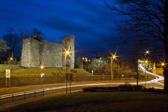
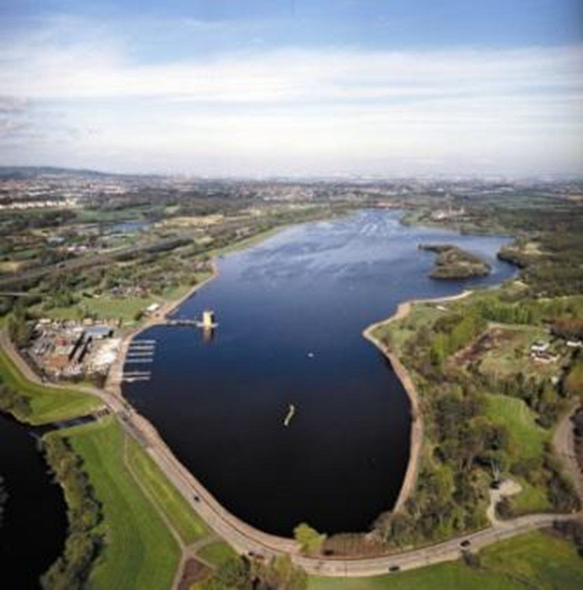
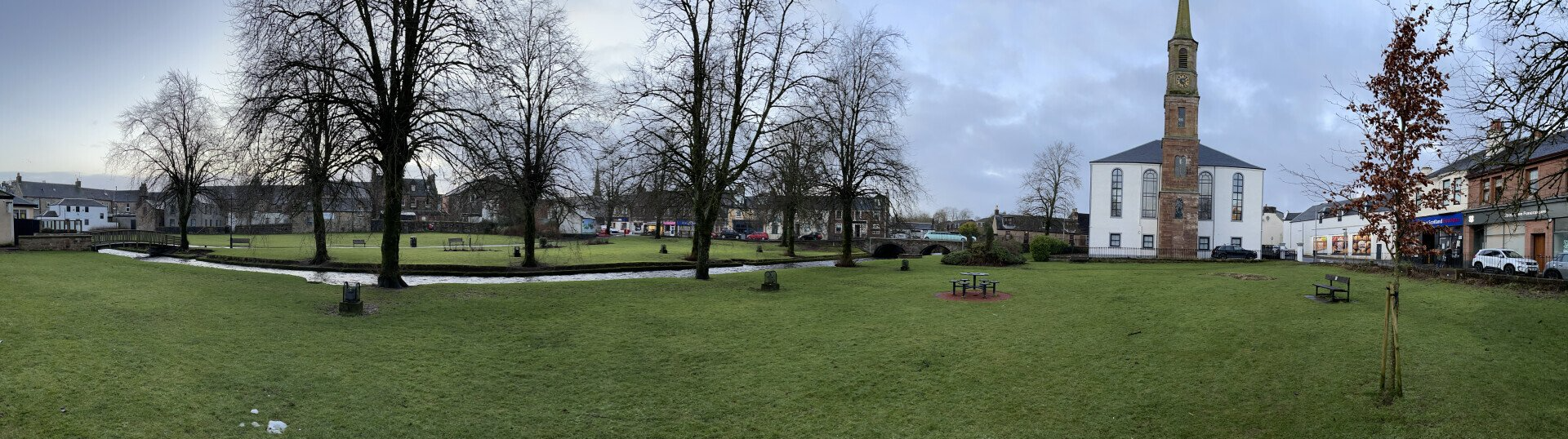
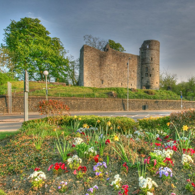
Gallery